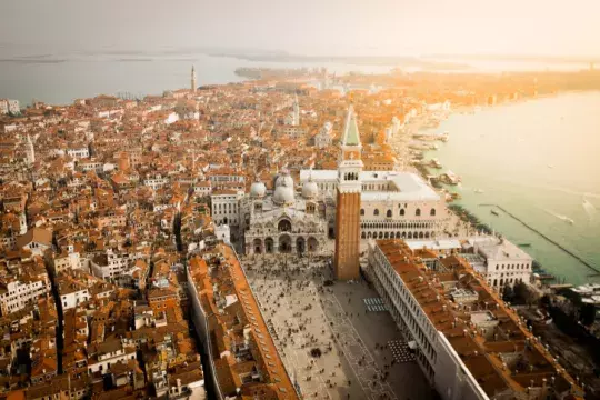
The Venetian Lagoon is built on 118 islands that are linked by over 400 stone bridges. Whether you plan a trip to an island full of colourful cottages named Burano or decide to visit an island called Murano, which is a centre for glass making, or you just decide to admire the beauty of an island called San Francesco del Deserto, you won’t get bored.
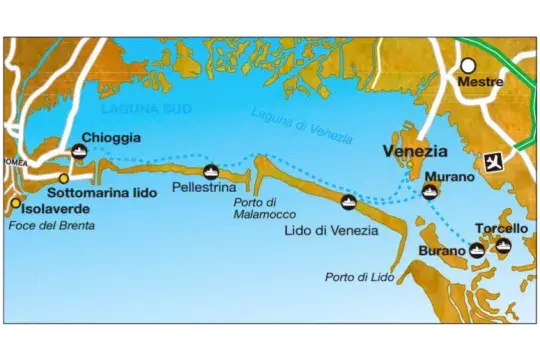
But first, let’s talk about geography! The Venetian Lagoon consists of two barrier islands- Lido and Pellestrina, which form central part of coastal lagoon. The north of the lagoon is surrounded by peninsula Cavallino/Punta Sabbioni and the south part is formed of peninsula Sottomarina.
Access to the Venetian Lagoon
You can access the Venetian Lagoon from the sea via Lido (northern and the widest entry), Malamocco (central, the deepest one and used by cargo ships) and southern Chioggia (for smaller and cruise ships).
How to get to Venice Lagoon
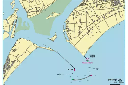
The Porto di Lido is the principal (and busiest) entrance to the lagoon.
Northern access to the Venetian Lagoon is delimited by two impressive breakwaters.
Murano lighthouse and its black & white stripes marking is clearly visible with the naked eye from the exterior side of the port which is 300° 40'. This lighthouse provides you with direction to the lagoon. It is important to pay attention to sea current, which can be too intense. Lido is the widest entry (approximately 1 km) and is used by cruise ships for travelling to Venice.
Dangers: Shallow water on the sides of navigable canals. Canals marked with Briccolas normally are not equipped with light signals and that makes the access during night more difficult, dense fogs especially during winter.
Sea bottom: sand, mud
Radio: VHF Channel 16-11 (nonstop service).
Prohibited: anchoring, fishing, and any other nautical activity
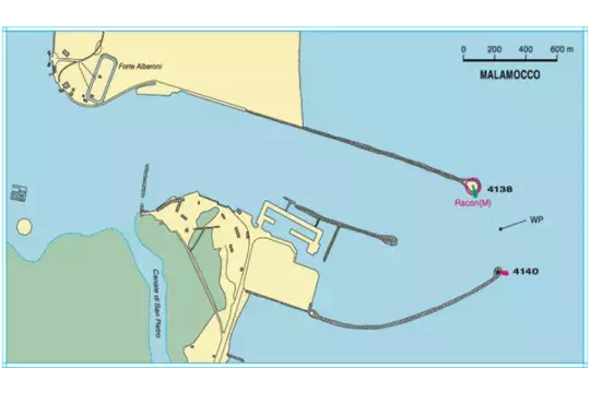
The entrance of Porto di Malamocco lies half way along the long sandy spit that protects the lagoon of Venice.
Malamocco
The central access to the Venetian Lagoon. Two long dams protect the entry, which is possible to lead by balancing to 287° 20' in case of emergency. The entry consists of the Rocchetta lighthouse with black & white stripes.
The entry Malamocco is the deepest one and is used by cargo ships and oil tankers for accessing a port named Marghera, which is a port that is important for market and industry purposes.
Dangers: Shallow water on the sides of navigable canals. Canals marked by Briccolas normally are not equipped with light signals and that makes the access during night more difficult, dense fogs especially during winter.
Prohibited: anchoring, fishing, and any other nautical activity. This area is marked with red buoys: all the ships passing between dams must pass slowly, so the waves don’t arise. It is prohibited to anchor in the port
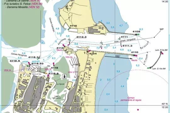
The entrance of Porto di Chioggia is between two long breakwaters extending E from the long, low spit of land that protects the lagoon from seaward.
Southern entry to the Venetian Lagoon is equipped with two long breakwaters that stick out to the east and there is also another breakwater nearly named Lunata, which is located on south-east, and forms two entrances located on south and north-east via estuary of the port.
Navigation on the channel marked with Briccolas with a maximum speed of three knots. Keep the axis of the fairway.
Dangers: keep the distance of at least 200 m from heads of dams, so you avoid submerged rocks. Keep the fairway delimited by buoys and Briccolas, so you avoid shallow waters.
Sea bottom: sand and mud
Radio: VHF channel 16
Winds: north-easterly is dominant
Lido
What’s next?
We made it successfully to the Venetian Lagoon and now we will provide you with a few advice how to continue navigating. It’s a lot easier during daylight, however, it is important not to panic and to stay calm even when it gets dark. Here are few things that are important to follow, so you avoid any troubles.
Briccola & Meda
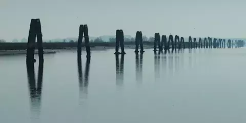
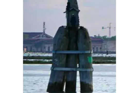
Briccola is the most crucial helper when it comes to navigating the Venetian Lagoon. Those are three stones that are connected via a steely ring on the upper side. Normally it is found in two rows on the body of water. If you are navigating between two rows of Briccolas, everything should be fine. It is also possible that you navigate with only one row of Briccolas. Then you should be navigating on the side that is marked with numbers. Or you can observe colourful markings. The white one marks the side of the canal, when we see green marking, we keep ourselves on the starboard and when we see red marking, we keep ourselves on the port side of the ship.
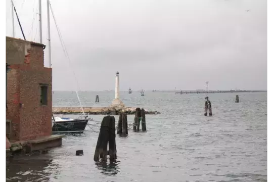
Fairway marking.
There is also a row of individual navigational trunks, so-called Meda, which are normally situated alongside of the shore.
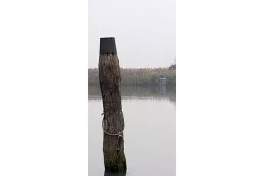
The most common designation in fairway.
Crossroads and turnings are marked with Briccolas called Dama with short stakes on the upper side. The number in the red square marks speed limit of the navigation. Big marine ships, ferries, police watercraft and rescue lifeboats have the right of way.
Marking of crossroads and turnings in fairway.
If for some reason you decide to leave the fairway marked with Briccolas and you get stuck in a shallow water or mud, you can call rescue boat that will help you to get back to the fairway. This service is free of charge. However, if you get stuck in navigable canal due to low tide, you will have to wait there until high tide. The height of the high & low tide can reach up to 1 metre, so keep this in mind while anchoring in a port, so your boat does not end up being “hanged”.
Anyway, such an expedition is doable without any problems, you just have to keep the fairway and stick to the rules. The views that you can see thanks to such expeditions as well as the panoramic view of this impressive “City of Water” are worth it.
Chioggia
Marinatips Team
